
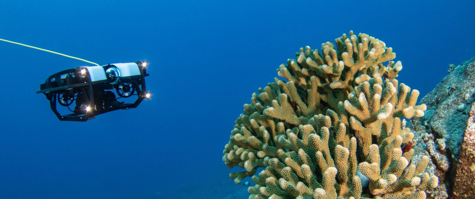
Marine robotic vehicles, like ROVs (Remotely Operated Underwater Vehicles), AUVs (Autonomous Underwater Vehicles), and USVs (Unmanned Surface Vessels), are useful subsea tools with endless capabilities, from inspecting shipwrecks to monitoring ecosystems to recovering missing objects to mapping the seafloor.
There are service providers around the world who can assist in getting a job done, and while the types of services provided by these companies vary a lot, there are some core capabilities that many of them offer that can be used in a wide range of applications. Those capabilities often include…
Underwater Photography/Videography
Cameras on both remotely operated and autonomous underwater vehicles provide high resolution images and video footage and allow users to perform visual inspections. Commercial divers can also use vehicles equipped with cameras to inspect areas for safety before sending divers down. The BlueROV2 can do this out of the box, but some users choose to upgrade to higher-end cameras, like this one using a Z-Cam cinema camera.
BlueROV2 with custom housing for Z-Cam E2 S6 cinema camera
Bathymetry/Hydrography
Bathymetry is the depth measurement of oceans, seas, and lakes. Hydrography includes bathymetry, but also the shape and features of the shoreline and the chemical properties of the water itself. Both can be used for charting and navigation purposes, determination of marine boundaries, investigation into beach erosion and sea level rising, understanding ocean currents, and more.
It is often necessary to determine water depths or properties while performing many of the above-mentioned surveys, which is where bathymetry and hydrography come into play. ROVs integrated with the necessary sensors, typically an echosounder like the Ping Sonar Altimeter and Echosounder, can be used to perform bathymetry and hydrography, like this bathymetric survey of a lake and dam.
Object Recovery
Diving is expensive and dangerous. ROVs can assist with search and rescue and retrieving lost objects, which is why police departments, fire departments, and the like have begun utilizing them. This Utah Department of Public Safety’s Dive Team uses the BlueROV2 as a safer and more affordable option. Manipulators, like the Newton Subsea Gripper, allow the operator to grab objects and return them to the surface.
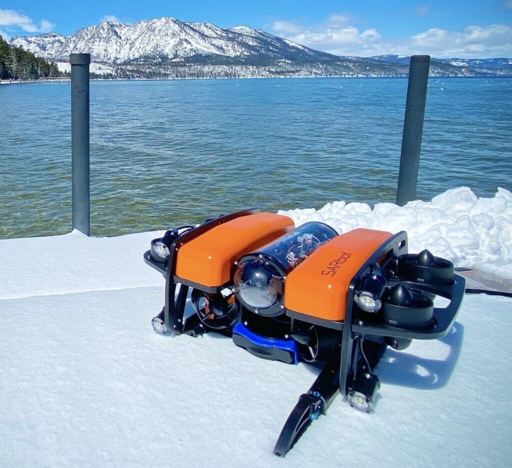
SARbot by BlueLink equipped with Newton Subsea Gripper
Photogrammetry
Photogrammetry is the art and science of extracting 3D information from photographs. Now with numerous camera and sensor options, ROVs can be transformed into high-tech photography machines, capturing images from under the sea and transforming them into 3D models, like this one of Adamić Pier by Vectrino and this one of a subsea pipe by Savante.
Water Sampling
During aquaculture and environmental surveys, water sampling can be used to test the water quality for pollutants, salt levels, and other water quality parameters. ROVs equipped with water sampling attachments, like this syringe-style sampler by Deep Trekker, can collect samples from various depths and locations while also inspecting the surrounding areas.
Inspection and Survey Applications
These capabilities are useful in many applications. Below are some of the most common applications where we see marine robotics being used by service providers to bring value and useful information to their clients.
Aquaculture Inspection
Aquaculture is the breeding, raising, and harvesting of fish, shellfish, and aquatic plants. ROVs are beneficial when it comes to inspecting various stages of production, including net inspection for fish security, net cleaning, monitoring fish health, and mortality extraction. This is done with both human-piloted ROVs and autonomous AUVs. One autonomous example is Richard Green and his team at the University of Canterbury, who developed a farm scanning system to help with aquaculture maintenance using a BlueROV2 and their own virtual piloting software.
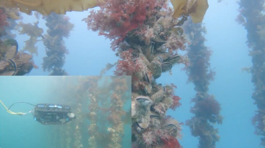
BlueROV2 inspecting mussel lines using virtual piloting software
Environmental Survey
Environmental surveys help us understand what is affecting our waters when it comes to pollution, hazardous substances, climate change, and more. They can also be used to monitor ecosystems and study marine organisms and their habitats, like this BlueROV2 being used by NIWA New Zealand to develop a non-invasive method of surveying scallop populations.
Infrastructure Inspection
ROVs are important tools for inspecting the structural conditions of already existing waterways, bridges, and dams to ensure their safety, like ROV Orca by Planys Technologies. They can also be used to survey areas where new construction will take place. ROVs outfitted with the proper sensors can help identify the impact of construction and infrastructure on the surrounding ecosystem.
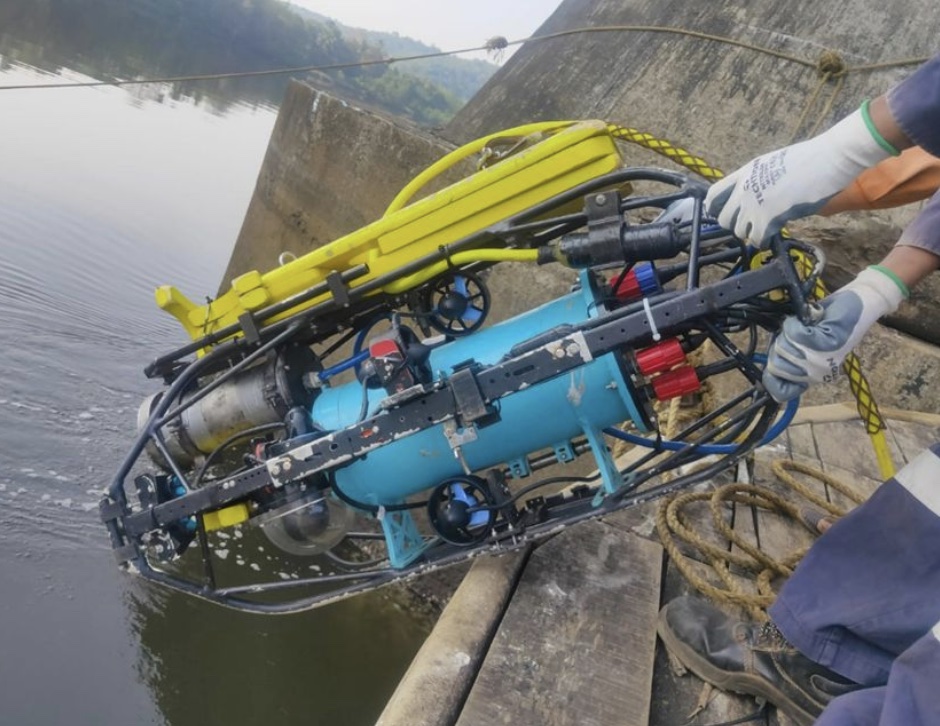
ROV Orca by Planys Technologies
Pipe Inspection
Inspecting pipelines in various industries and locations, such as sewers, potable water pipes, rainwater drainage pipes, and oil and gas pipelines is neither an easy nor safe task. ROVs equipped with lights, cameras, and sonar, like the new HD3 by JM Robotics, can be used to inspect the structural integrity of these pipelines and check for issues like corrosion, leaching, and temperature and pressure resistance. They can also be used inside the pipes to check for blockages.
Ship/Boat Inspection
Performing subsea inspections of ships and boats is important to ensure they remain functional and safe. ROVs equipped with cameras can allow the crew to inspect the exterior of the ship without having to get in the water. This BlueROV2 by Fraunhofer IGP can not only inspect the exterior of a ship, but can actually repair damaged coatings of maritime structures while underwater!
Tunnel Inspection
Like pipe inspections, tunnels are another hard-to-reach space. Tunnels can include mining operations, large draining channels, aqueducts, and culverts. ROVs, AUVs, and USVs, like the Platypus Explorer by Abyss Solutions, can utilize sensor and robotic engineering advances to inspect these tunnels without having to drain the water and inspect with humans. Abyss Solutions uses both LiDAR above the water and sonar below to create 3D maps of the tunnels.
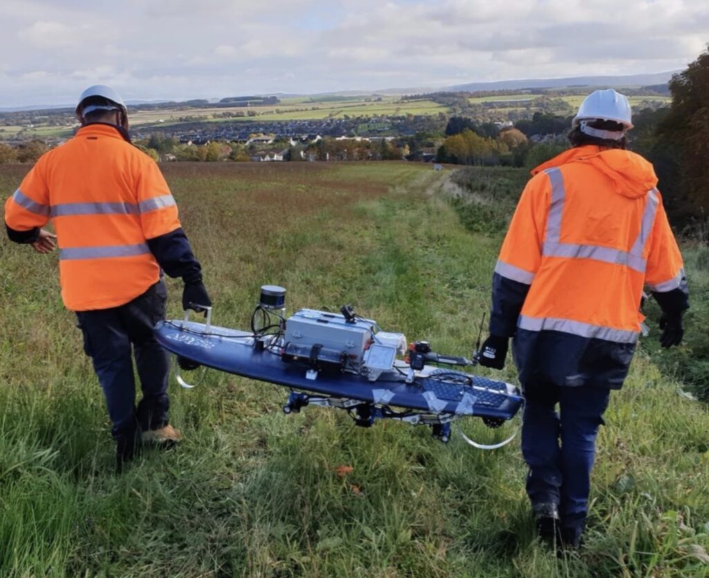
Platypus Explorer by Abyss Solutions
With all of the customizations and modifications possible, the world of marine robotics is forever evolving. If you’re not ready to own one of these vehicles yourself but are interested in exploring more, we have created a Service Providers Map to help connect you with a service provider in your area!