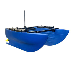
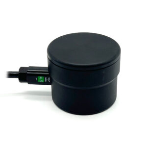
The Cerulean Surveyor is a multibeam echosounder that transforms the BlueBoat into a powerful bathymetry and seafloor mapping machine. What sets the Surveyor apart from other multibeam sonars is its affordability, offering high-precision sonar technology at a fraction of the cost.
Cerulean Surveyor Multibeam Echosounder

$5,132.00
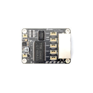
The Surveyor 240-16 is a compact, low-cost multibeam echosounder perfect for the BlueBoat and other small USVs. It has a depth range of up to 100 meters and a built-in IMU to provide pitch and roll compensation for accurate results, even in rough water. Paired with SonarView software, the Surveyor generates real-time 3D point clouds of the seafloor for bathymetric surveys and mapping.
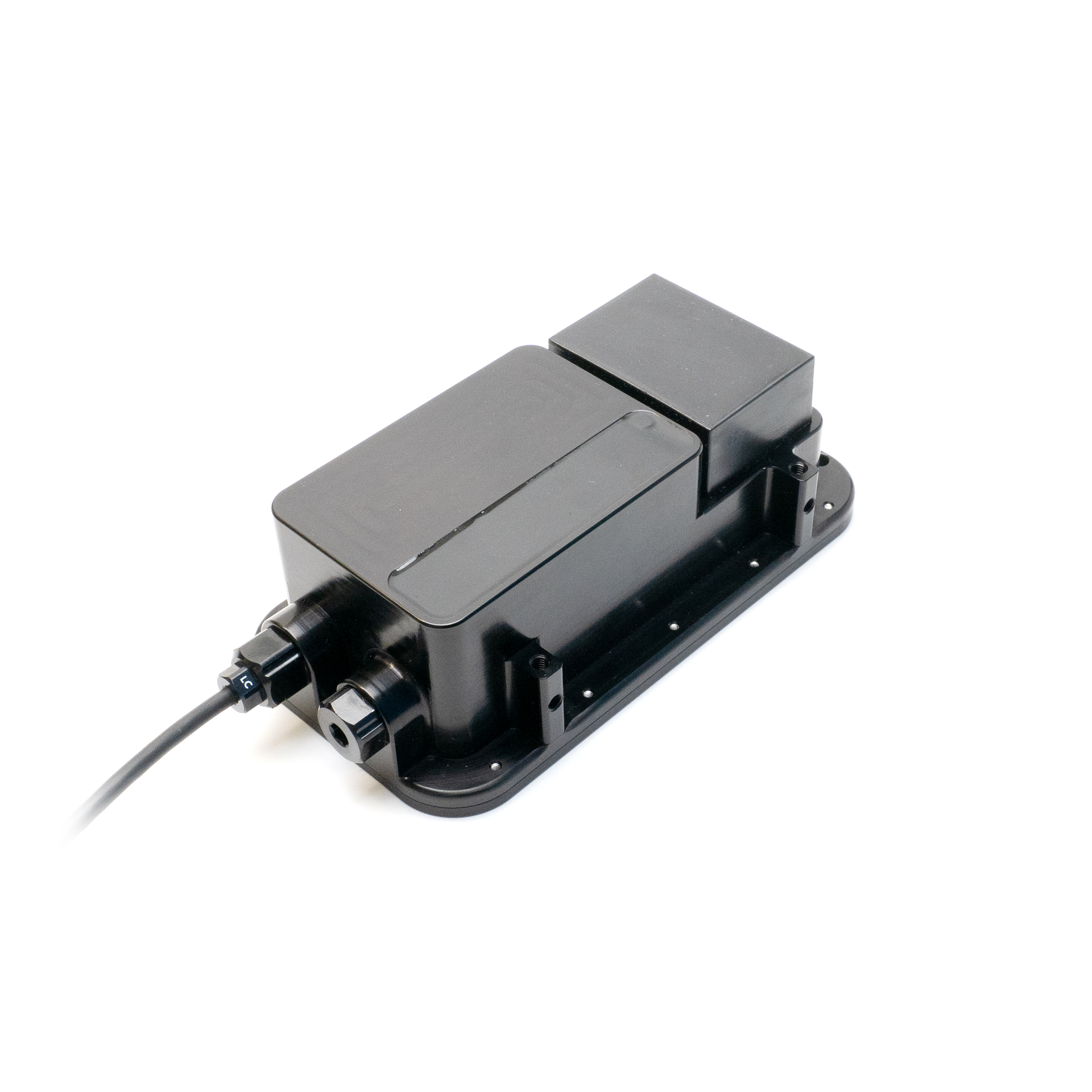
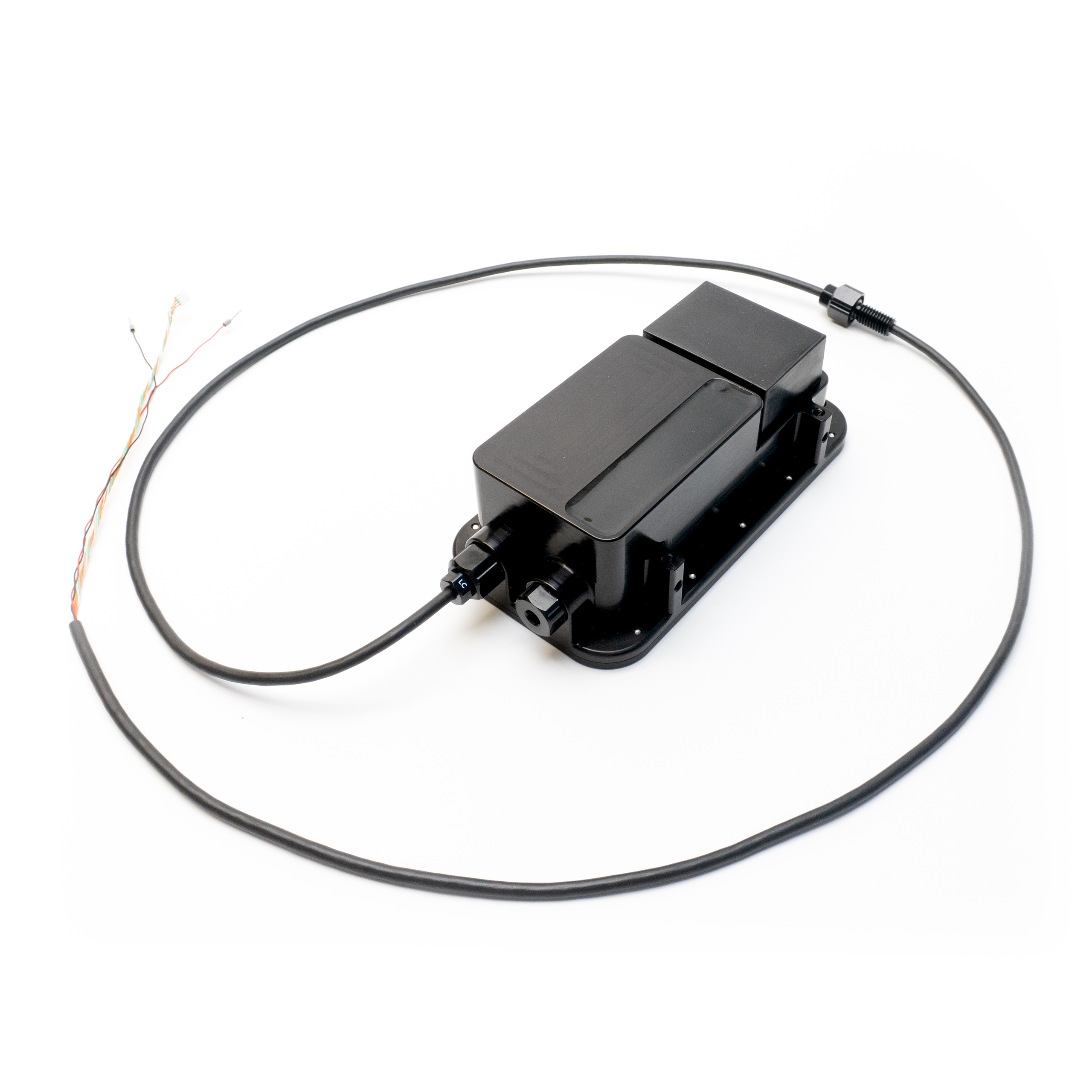
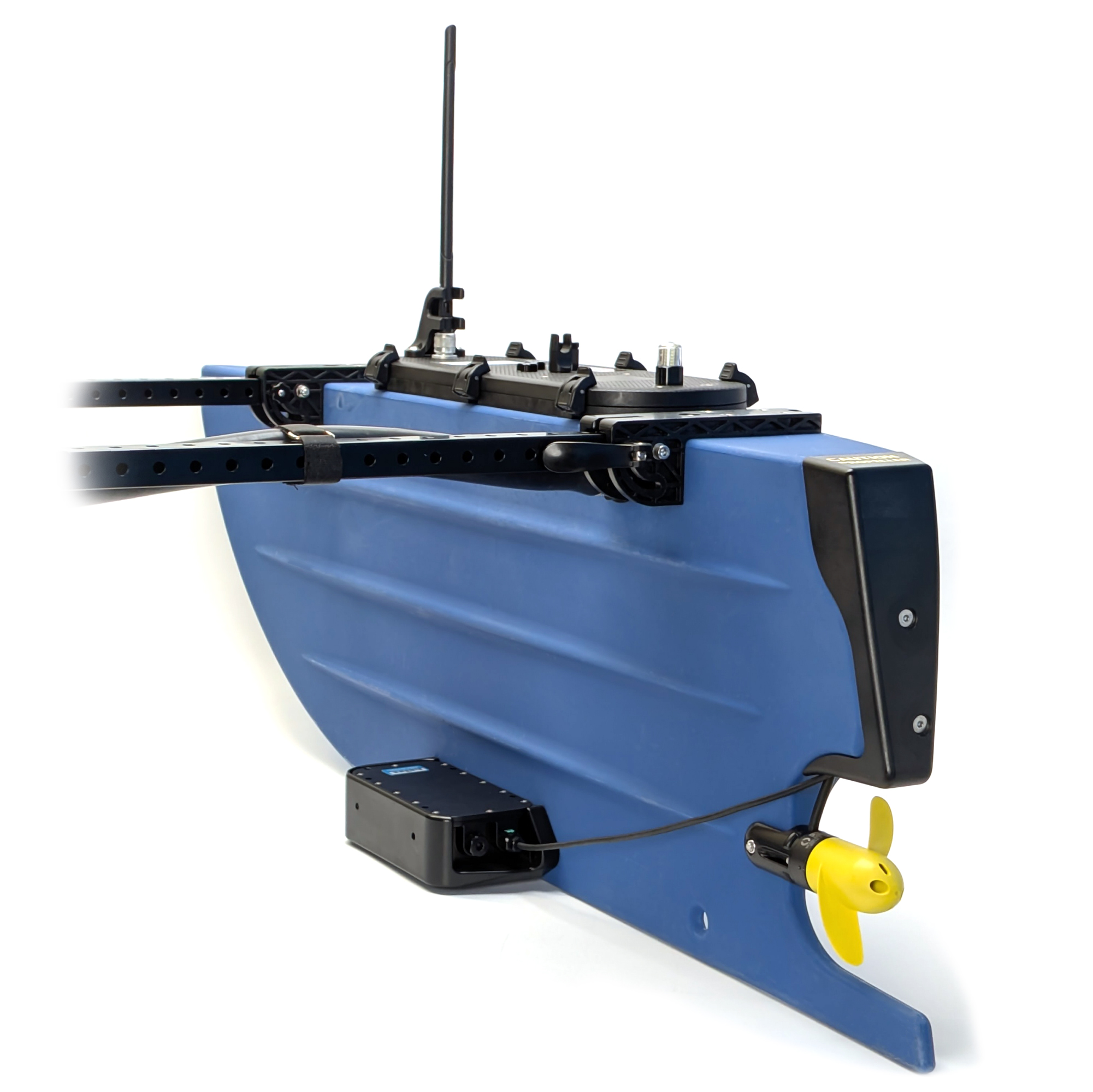
Includes mounting bracket and all hardware and cables needed for installation on the BlueBoat. Requires an Ethernet Switch onboard the BlueBoat for operation.
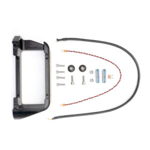
The Surveyor mount arrived with minor surface scratches that do not affect functionality. Due to these aesthetic imperfections, we have applied a 10% discount to the $180 list price.
10 in stock
Product Description
What is a Multibeam Echosounder?
A multibeam echosounder is a type of sonar used to map the seafloor or underwater terrain. Unlike a single beam echosounder, which only measures one point of depth directly beneath it, a multibeam echosounder captures many depth points at once to quickly map an area in detail.

Mapping the Depths
The Surveyor works by sending out 240 kHz sound waves in a wide 80-degree swath, allowing it to map large areas quickly. It then uses a 16-element receive array to listen for the returning echoes. By measuring the strength and time of each return, the system calculates the angle and depth of a wide swath of points on the seafloor from a single ping. It typically measures depths up to 100 meters below the vessel, with even greater range possible in ideal conditions.
Combined with the forward motion of the vessel, these depth points form a point cloud, which is used to create a detailed 3D map of the underwater terrain.
A built-in 9-axis inertial measurement unit provides pitch and roll compensation, so the movement of the BlueBoat won’t distort the data, even in choppy waters. The aluminum housing is depth rated to 300 meters, so it can also be used on AUVs (but this will require different parts!).
Streamlined Data with SonarView
The Surveyor works with Cerulean’s SonarView software, which is available as a BlueOS extension. SonarView provides a real-time point cloud visualization of your data while surveying. SonarView collects heading and GNSS position data from the BlueBoat and combines it with the depth measurements to accurately place each point in its correct geographic location.
All sonar data is logged directly on the BlueBoat and can be replayed or exported as CSV point cloud data or GSF for post-processing in software like:
- ReefMaster or SonarWiz to generate maps
- point cloud viewing software like CloudCompare
- most hydrographic survey software

Built for BlueBoat
When purchased directly from the Reef, the Surveyor comes with a mounting bracket and all the hardware and cables needed for installation on the BlueBoat. The Surveyor connects to the BlueBoat via Ethernet, so you’ll also need an Ethernet switch onboard. We’ve got a full integration guide with all the details to make setup easy.
In the United States and looking for sonar funding for your project? Check out The Sonar Equipment Fund!
Product Description
The Cerulean Surveyor is a multibeam echosounder that transforms the BlueBoat into a powerful bathymetry and seafloor mapping machine. What sets the Surveyor apart from other multibeam sonars is its affordability, offering high-precision sonar technology at a fraction of the cost.
What is a Multibeam Echosounder?
A multibeam echosounder is a type of sonar used to map the seafloor or underwater terrain. Unlike a single beam echosounder, which only measures one point of depth directly beneath it, a multibeam echosounder captures many depth points at once to quickly map an area in detail.
Mapping the Depths
The Surveyor works by sending out 240 kHz sound waves in a wide 80-degree swath, allowing it to map large areas quickly. It then uses a 16-element receive array to listen for the returning echoes. By measuring the strength and time of each return, the system calculates the angle and depth of a wide swath of points on the seafloor from a single ping. It typically measures depths up to 100 meters below the vessel, with even greater range possible in ideal conditions.
Combined with the forward motion of the vessel, these depth points form a point cloud, which is used to create a detailed 3D map of the underwater terrain.
A built-in 9-axis inertial measurement unit provides pitch and roll compensation, so the movement of the BlueBoat won’t distort the data, even in choppy waters. The aluminum housing is depth rated to 300 meters, so it can also be used on AUVs (but this will require different parts!).
Streamlined Data with SonarView
The Surveyor works with Cerulean’s SonarView software, which is available as a BlueOS extension. SonarView provides a real-time point cloud visualization of your data while surveying. SonarView collects heading and GNSS position data from the BlueBoat and combines it with the depth measurements to accurately place each point in its correct geographic location.
All sonar data is logged directly on the BlueBoat and can be replayed or exported as CSV point cloud data or GSF for post-processing in software like:
- ReefMaster or SonarWiz to generate maps
- point cloud viewing software like CloudCompare
- most hydrographic survey software
Built for BlueBoat
When purchased directly from the Reef, the Surveyor comes with a mounting bracket and all the hardware and cables needed for installation on the BlueBoat. The Surveyor connects to the BlueBoat via Ethernet, so you’ll also need an Ethernet switch onboard. We’ve got a full integration guide with all the details to make setup easy.
In the United States and looking for sonar funding for your project? Check out The Sonar Equipment Fund!
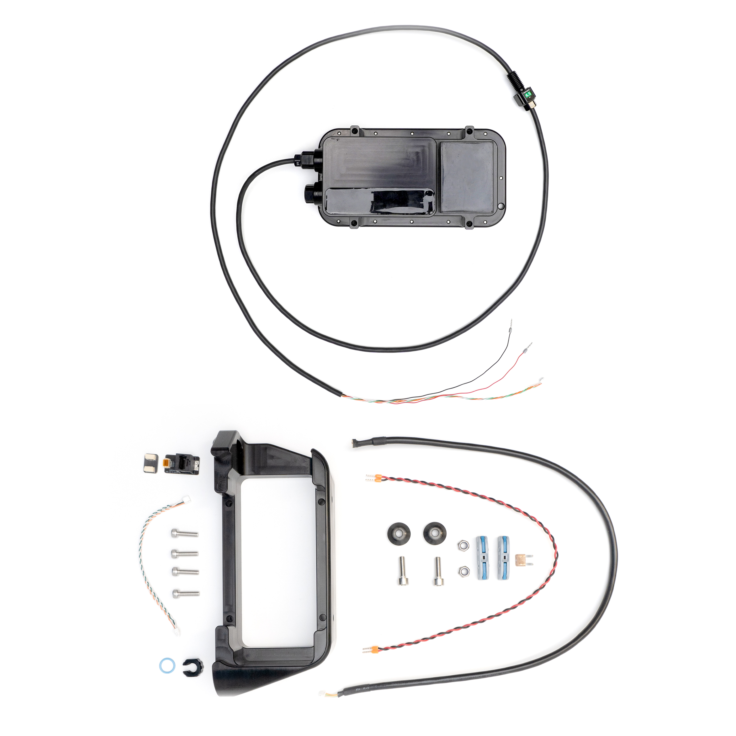
- 1 x Cerulean Surveyor 240-16 Multibeam Echosounder
- 1 x Surveyor 240-16 mounting bracket
- 1 x 600 mm JST GH to JST GH Ethernet extension cable (BR-103531-600)
- 1 x 400 mm power extension cable (BR-103533)
- 1 x 5A Mini Blade fuse (BR-101401-005)
- 2 x Inline snap connector (BR-103548)
- 2 x M6 nylon insert lock nut (BR-101258)
- 2 x BlueBoat Hull Mount Bushing
- 2 x M6x20 socket head cap screw (BR-102241)
- 4 x M5x18 socket head cap screw (BR-101191)
- 1 x M10 bulkhead nut & -013 O-ring (BR-100167-010)
- 1 x 150 mm JST GH to JST GH twisted pair cable
- 1 x 4-position JST GH to JST GH coupler (BR-100509)
- 1 x RJ45 to to JST GH adapter
Specifications
| Parameter | Value | |
|---|---|---|
| Electrical | ||
| Supply Voltage | 10–30 V | |
| Max Idle Power Consumption | 5 W | |
| Max Power Consumption | 15 W | |
| Acoustic | ||
| Transducer Frequency | 240 kHz | |
| Along Track TX Beam Width | 4° | |
| Cross Track TX Beam Width | 80° | |
| Cross Track Beam Width | 7° (conventional beamforming) | |
| Cross Track Angular Resolution | 1° (angle of arrival) | |
| RX Array Elements | 16 | |
| Maximum Suggested Range | 100 m | |
| Range Resolution | Up to 1/800th of range setting | |
| Communication | ||
| Interfaces | 100Base-T Ethernet | |
| Software | SonarView | |
| Application Programming Interface | API docs | |
| Max Bandwidth | 450 Kbps | |
| Tools | ||
| Compatible Bukhead Wrench | M10 (BR-100977-010) | |
| Bulkhead/Nut Wrench Flats | 16 mm | |
| Recommended Installation Torque | 3.5 Nm | |
| Physical | ||
| Depth Rating ¹ | 300 m | |
| Recommended Bulkhead Thru Hole Diameter | 10.2 mm | |
| M10 Bulkhead O-ring Size | AS568-013 Buna-N 70A | |
| Weight in Air ² | 790 g | |
| Weight in Water ² | 145 g | |
| ¹ Depth rating applies to Surveyor unit only. The pass through WetLink Penetrator at cable end must be replaced to achieve full depth rating. ² Weights are not including mounting bracket or integration hardware. |
||
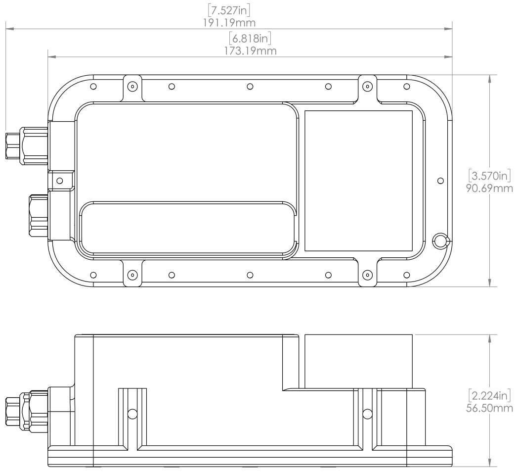
2D Drawings
Surveyor 240-16
3D Models
CERULEAN_SURVEYOR_240-16_BR-103522 (.zip)
SURVEYOR_240-16_MOUNTING_BRACKET_BR-103523 (.zip)
Revision History
22 April 2025
- BR-103522 – Initial release
Integrating the Surveyor Multibeam Echosounder on the BlueBoat
Learn how to integrate the Surveyor Multibeam Echosounder on the BlueBoat!