
Researchers set out to evaluate whether aerial drones and ROVs could serve as faster, more flexible alternatives to traditional snorkel and SCUBA surveys for monitoring sea cucumber populations across a range of depths on the Great Barrier Reef. The goal was to assess whether remote sensing technologies could overcome the limitations of conventional methods.
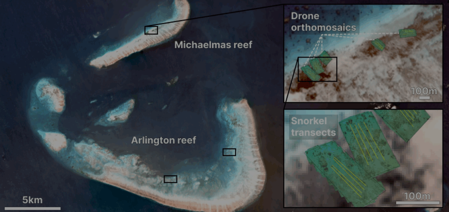
Abstract: There is an urgent need for improved monitoring approaches to rapidly and accurately assess sea cucumber populations at ecologically relevant scales. Timely surveys are critical for informing effective fisheries management and decision-making. Traditional surveys, undertaken via snorkelling, manta tows, or SCUBA, are limited to shallow and accessible areas; however, sea cucumbers inhabit a broad range of depths, including areas beyond safe diving limits and exposed shallow waters inaccessible by boat. To overcome these limitations and increase the rapidity of field collection, we propose the use of remote sensing technologies to survey sea cucumber populations across a range of depths. Here, we evaluated the effectiveness of aerial drones and in-water remote operated vehicles (ROVs) for assessing sea cucumber species and abundances across various depth ranges (< 50 m) on the Great Barrier Reef, Australia. Aerial drone orthomosaics and ROV video footage were compared to more traditional snorkel and SCUBA-based assessments conducted at similar depths. The vast majority of pairwise comparisons between in-water ROV video counts and snorkel or SCUBA assessments found no significant differences in sea cucumber assemblages. Counts from aerial drone-derived orthomosaics, however, were significantly lower, counting approximately half as many sea cucumbers as snorkel counts. This was largely attributed to poor weather during the drone surveys. Remote methods were significantly faster in the field for surveying a given area than traditional methods. Given that towed ROVs can efficiently cover a broader depth range and aerial drones are effective for survey shallow areas under suitable weather conditions, we recommend using a combination of aerial drones and towed ROVs to survey sea cucumbers, with tool selection guided by prevailing weather conditions. This approach offers the advantages of collecting multiple types of data from a single data source, vastly increasing survey efficiency, and providing a historical record for future assessments. The methods have the potential to be used to survey other benthic–associated species.
Authors: Williamson, J. E.; Joyce, K. E.; Duce, S.; Koopman, M.; Li, J. Y. Q.; Gaston, T. F.; Knuckey, I.; McSpadden, K. L.; Garner, N.; Cornet, V. J.; Burke, P. J.; Flynn, A.; Raoult, V.
Journal: Coral Reefs
To read more, click here!